Tuesday, July 31, 2012


Fairbanks to Haines

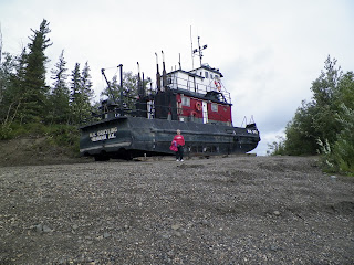
We made the trip from Fairbanks to Haines to get on the ferry for the Juneau, Wrangell and Prince Rupert inside passage. When we left Fairbanks, we left cell service behind. It was a quiet two days. The first picture is of the White River. Look and try to see the big wide river flowing in the picture.


We stayed in a Canadian National park for the night and went on to Haines Junction. Haines Junction is just where the Alaskan Canadian Highway and the road to Haines intersect. Due to the lack of any towns in hundreds and hundreds of miles, the intersections are named and talked about as if they were towns. Kathleen Lake is the name of the amazing park we stayed in for the next two nights. The second day was a hike up the mountain near the campground. Here are the pictures of the lake from ground level, 2,200 feet, and the top of the mountain, 4,700 feet.


Looking up (below), almost there, looking down above.


Friday, July 27, 2012


Deadhorse/Prudhoe Bay

We arrived in Deadhorse late in the day, just in time for dinner. Deadhorse like Coldfoot is a work camp, but for the oil workers. Deadhorse is an airport built by Alaska so the airport would be on public land. Just north of Deadhorse is the land-lease areas for the Oil companies and the contractors that work in the area. The whole area, referred to as Prudhoe Bay, is similar to an industrial park, but well maintained. The access to the Arctic Ocean is via a tour bus run by the security company for the area as the land-lease property is private property. We posed while dipping our finger in the Arctic Ocean. It wasn't as cold as it looks but the mosquitoes were numerous an we put our hoods on to help keep the mosquitoes off. The oil isn't pumped out of the ground, it is pushed out with pressure by injecting the natural gas and water into the ground so there are pipes from the wells and pipes back to the well.


The flight home was nice. We flew over the same land that we had driven through for the last two days. It looked much the same until we came to the mountains and the rivers. They look very different from the air. Darlene was apprehensive about flying on a small plane but boarded like a champ.


Tomorrow it is on to the the inside passage which means no cell coverage for a couple of days.


Second Day to Deadhorse

We got up early on Tuesday morning for the trip to Deadhorse. Breakfast started at 5:00 AM, remember this is a work camp. We traveled the short distance to Wiseman for a tour given by a local named Jack. Jack is a year round resident with a wife and a child on the way. He has grown children that has moved to Anchorage.

Living north of the Arctic Circle requires one to be resourceful. His house is equipped with the same stuff we have on offshore sail boats. Solar cells, wind chargers, battery banks, inverter and generator. The Generator needs to be heated prior to starting on cold days, down to -40 degrees and at times -80 degrees, and then placed in a box to heat the air as it is pulled into the generator. The solar is good in the summer when the sun never sets with the wind generator working on windy days. The house is a small house to keep energy demands down. The refrigerator, or cold storage, is a hole cut into the floor with hatch type access. It never gets above 40 degrees, even in the summer time. Heating and cooking is accomplished with wood as the cost of fuel oil is over $3,000 a winter. He spends 3 months splinting wood for the nine months of winter.

Jack is also a trapper/hunter and traps and hunts all winter for income and food. He goes out in the -40 degree weather but has proper clothing, mainly animal skins. He does studies for different agencies in both the summer and winter, along with tours. He was collecting salmon DNA samples for the University of Alaska. Jack was a very interesting person and I thoroughly enjoyed the tour of Wiseman.


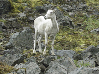
The next major site was Atigun Pass where we saw the Dall sheep. It is a major avalanche site. The approaches to the pass are kept open using artillery shells to cause an avalanche under controlled conditions. There are gun mounts placed for the artillery which look like small raised platforms with a steel pole in the middle. 


As we descended from Atigun Pass, the terrain changed to tundra and is refereed to as the North Slope. There had been several fires along the way that burned off the ground cover and some times the trees. After a fire, the fire weed would be the first plant to take root. I don't know if they bloom all summer, but they were putting a beautiful display as we drove.


The tundra, which is permafrost, has an unusual appearance due to the freezing and thawing of the surface. The subsurface stays frozen, which makes it permafrost. The water freezes and spreads the land to make the interesting lakes and geometric shapes in the land with dispersed areas of water.


The pipeline is interesting on how it is constructed. The supports that go into the ground would defrost the ground causing big problems. On top of the supports are cooling fins with a passive anhydrous ammonia cooling system. When the air temp is 4 degrees below the ground temp, in the winter, the cooling system removes heat from the ground, insuring it remains frozen in the summer. Notice the ice, or permafrost, in the picture below.

 
Next, Deadhorse/Prudhoe Bay


Thursday, July 26, 2012


The trip to the Arctic Ocean was a long and grueling trip, but well worth the time. The distance was only 500 miles, but took two 12 hour days. The road is mainly gravel, with portions that are poorly paved except maybe 20 miles of good pavement and a maximum speed limit of 50 MPH. The scenery was aw inspiring and the animals were amazing.

The first day was to Coldfoot, under rainy skies and cool weather, the high for the day was 57. We were travailing with three other couples and a tour guide. We would stop often for a rest stops and photo opportunities. We had lunch at the Yukon river and the photos below.


One of our goals on this trip was to cross the Arctic Circle, which is defined as that latitude in which on the summer solstice, the sun does not set and on the winter solstices the sun doesn't rise. With the tilt of the earth always changing, this is a moving target. We actually crossed the arctic circle, N66 33' 44” a little ways up the road.


As we traveled on to Coldfoot, the scenery in the pictures below don't do the views justice, but here they are:


We arrived in Coldfoot, tired and hungry. Coldfoot is a work camp where most of the road construction workers lived and ate breakfast and dinner. There isn't a hotel or motel as we are used to, as the pictures below show.


That evening after dinner, we attended a presentation by a ranger of the National Parks Service on how to avoid bears. So far, they seem to scatter when they see us. Next post will be day two of our trip.


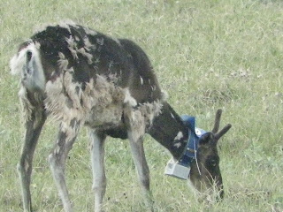
Here are the animals we photographed:


wolverine
 carabou


Dall sheep
Ruff-legged hawk
Tundra swan
Muskox


Sunday, July 22, 2012


We are going on our trip to the Attic Ocean trip on Monday, so we have been cooling our heals here in Fairbanks. We went to the Eskimo Olympics for the past couple of days. The athletes where mainly young adults in our Sea Scouts age range. The events were unique and we got some movies of some of them.


Well there seams to be a problem in uploading videos. I will try again when I have a better connection. There was a baby competition, here are some of the babies.


Sunday, July 15, 2012


Trip to Chena Hot Springs

We took a trip to Chena Hot Springs, which means this area is geologically active. We saw a moose on the way so here is another moose picture.


Here is one for Heather, we found a dragon, You should see the dragon droppings.


We took a hike along a stream and happened upon this beaver lake and dam.