Monday, February 24, 2014

San Cristobal Island

San Cristobal Island

Let me start out by quoting a phrase from the Interpretative center on San Cristobal, “God had a lot of rocks left over from the creation of earth and piled them all in the Galapagos”. The rocks were extremely large, islands sticking out of the water from 200 feet, to huge, big, medium and small. Every where we walked the rocks were apparent. If you were walking on gravel or dirt it was ash that had filled the gaps in the rocks. The first glimpse from sea was of a massive island looming high above the horizon, and we arrived at night. The islands are mostly national park. 93% park and 3% private land with a few towns and land for farming.


On San Cristobal, our first stop, we were welcomed by sea lions in-mass. We had to block the open transom to keep the sea lions from coming into the cockpit. We allowed them on the swim platform, as it would be impossible to stop them. One night, a large male sea lion figured out how to get around our blockade. Brian got up and saw him siting up in one of the chairs as if he belonged there, head held high. He made a quick dive over the side as Brian opened the hatch.


On our first day we walked to a close by beach, 45 min to an hour walk. The beaches are mostly coral sand, mixed with the ash sand and lots of rocks. We were amazed to see and swim with a couple of sea turtles, and of course the sea lions. The the next day was a tour to see the only fresh water lake in Galapagos. It is in an extinct volcano crater. The hike was about a quarter mile up a steep trail. With this being the tallest place on the island, the moist Pacific air turned to rain and fog as it was lifted up over the volcano. The lake was visible for about three minuets and one photo. From there it was on to the blue footed booby. A photo that Darlene must have for her Galapagos trip. We took the pictures of the cactus that has a pine tree trunk as we walked to the beach.Then up the rocks again for the blue footed booby. From there it was on the the turtle breeding farm. There they have some breeding stock and then release the turtles when they are five years old.


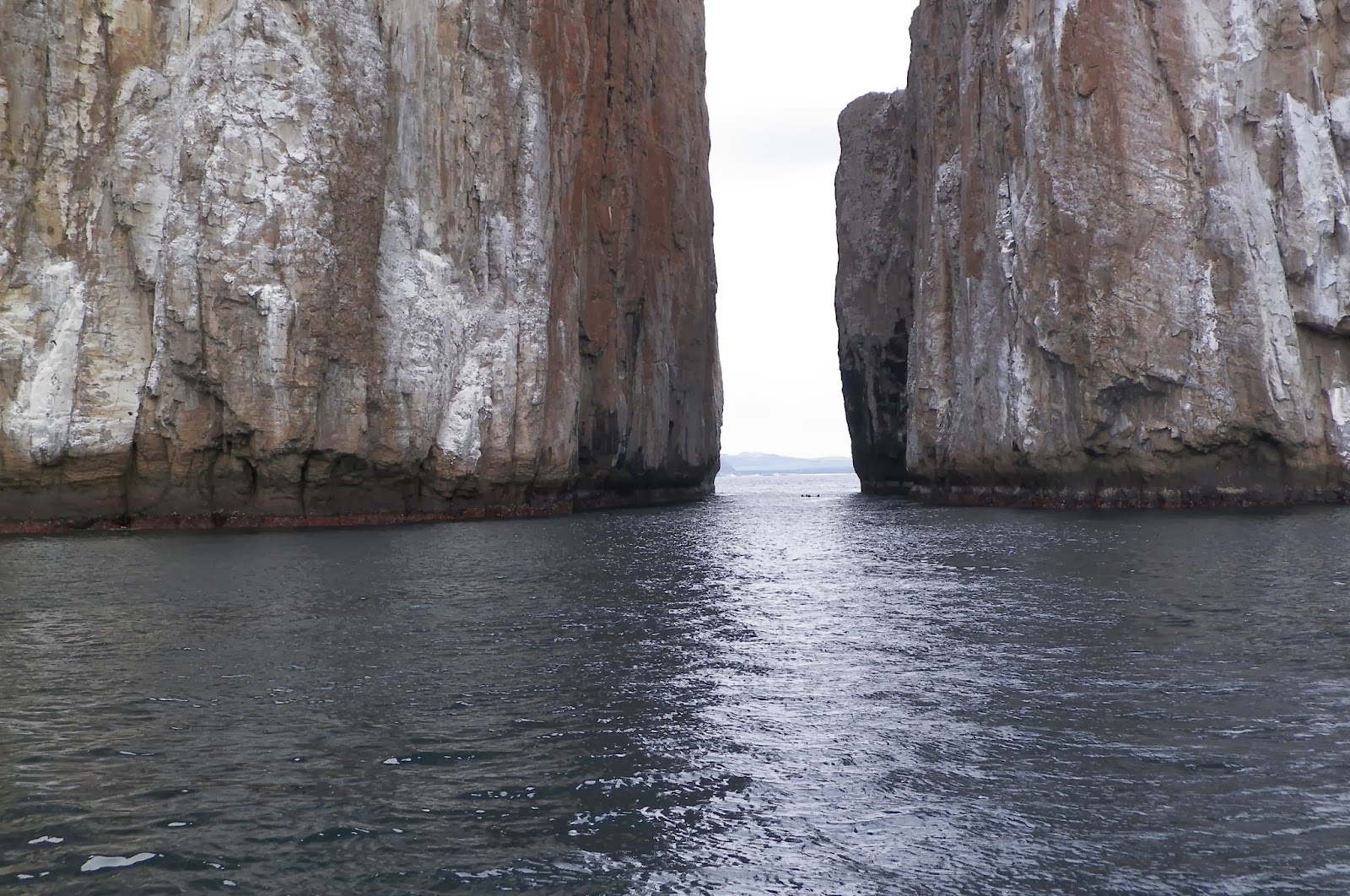
The following day we went on the Kicker Rock tour. Kicker Rock is a large, no huge rock that juts out of about forty feet of water to a height of half a mile. The boat dropped us off next to the rock and we started snorkeling. The first look down showed a school of fish about half way to the bottom. Under the school of fish were many sharks. We weren't worried as there was so much food, that we are not on their menu. Brian took the shark picture with his Go Pro camera about twenty-five feet down. We also saw some eagle rays along Galapagos sharks, white and black tip sharks. We swam thru the opening between the rocks around to the other side. All the time looking at sharks, and fish at different levels. When it was almost time to get out of the water, we discovered a bait ball, a very large school of small fish swimming in union son. It was almost if it was one animal. I tried to swim through the bait ball, but it would change shape as I approached, never letting me get to it. A sea lion was. however swimming through and getting it's fill.


Friday, February 21, 2014

Check-in/OK message from SPOT Heyne

Heyne
Latitude:-0.84850
Longitude:-90.49240
GPS location Date/Time:02/21/2014 10:57:25 EST

Message:on our way to Isabela

Click the link below to see where I am located.
http://fms.ws/FguC-/0.84850S/90.49240W

If the above link does not work, try this link:
http://maps.google.com/maps?f=q&hl=en&geocode=&q=-0.84850,-90.49240&ll=-0.84850,-90.49240&ie=UTF8&z=12&om=1

Heyne

You have received this message because Heyne has added you to their SPOT contact list.

Ready for Adventure
FindMeSPOT.com

Thursday, February 20, 2014

Friday, February 14, 2014

The Doldrums

The Doldrums

The trip from the Las Perlas islands to Galapagos goes through the doldrums. Most everyone knows that is an area between the northern trade winds and the southern trade winds. I don't think most understand how large of an area it is. On the weather maps, it is an area of about 600 square miles. We started from the Las Perlas Islands under spinnaker and were making 6 to 7 knots. Around sunset, the wind started to gust to 20 knots so we rolled out jib and took down the chute.
The wind continued to blow until around 3 the following day when it started to die and went slack in about 2 hours. From a steady 18 to 5 knots in about two hours. We were prepared for this and started the motor. The lack of wind didn't curtail the waves, which were running behind us at about 3 to 5 feet with an occasional 8 footer. The auto pilot did well and we motored into the night. The next morning the waves were down to a couple of feet but still 3 to 5 knots of wind. We motored into the afternoon as the waves continued to get smaller. By around 3 pm the waves were left over rollers about 2 feet. The wind was 0 to 5 knots.

It was almost as the wind was teasing us. A zephyr would work it's way in making us think the wind was picking up, but then nothing again. Then from a different direction, it would start to build, again teasing us then going away. Some times it would come from opposite directions, but usually from the southwest and south east. I suspect the zephyr were from clouds causing thermals on the water.

On the second day, I noticed that the rollers were now from the southwest instead of out of the northeast, the direction we had come from. It was about eight hours later that we had solid 5 to 8 knots out of the southwest. Enough to sail. The motor went off and we were sailing again. We sailed for another eight hours when the wind switched to the southwest, the direction we were heading. The change in wind direction was foretold by the change in the ground swells. We tried of the motor on and off, jib in and out, as the wind was constantly changing, as it would continually swing between south, southwest and southeast. We basically motored 600 out of the 850 miles from the Las Perlas Islands to the Galapagos as did most of the fleet.

Enjoy the pictures from the doldrums.

We also have a picture of our new crew. Not much of a crew really, he stinks, lays around all day and makes terrible noises.


The movie is our toast to Neptune as we crossed the equator.


We also have a picture of our new crew. Not much of a crew really, he stinks, lays around all day and makes terrible noises.

Thursday, February 6, 2014

Las Perlas Islands

Our trip to the Las Perlas Islands, which received their name from the pearls that are found there, was mainly a motor trip. The wind was under 10 knots except the last couple of hours to our first anchorage at Isla San Jose.

We anchored in Ensenada Playa Grande, and were the only boat in the anchorage. When the moon set a little after sunset, it was total darkness except for the stars. Jupiter was noticeably visible along with Orion and Canus. There seams to be a local phenomena that the wind picks up to about 15 to 20 knots after sunset and settles back down around midnight. The anchorage was a little ruff for this period as the waves would wrap around the point and hit us on the beam. Still, we slept well.

The next morning we went exploring as the beaches looked enticing. As we approached the beach we were amazed at the unnoticeable ground swells would start to lift about fifty feet from the beach and then break just before the shore line. Then about every twentieth wave would be larger than the rest. Brian wanted to stop short of the breakers and walk in, I said no we can surf in. Well Brian was right. We almost made it to the beach but flipped at the last second. After recovering from the flip, we were missing Brian and my glasses. We did recover the anchor bag when Brian tripped over it with anchor still in the bag. So I took of my shoos and started to look for my glasses and luck was on my side. However we didn't recover Brian's sunglasses. We suspect that my glasses were metal and sank, while his were plastic and drifted out with the waves.

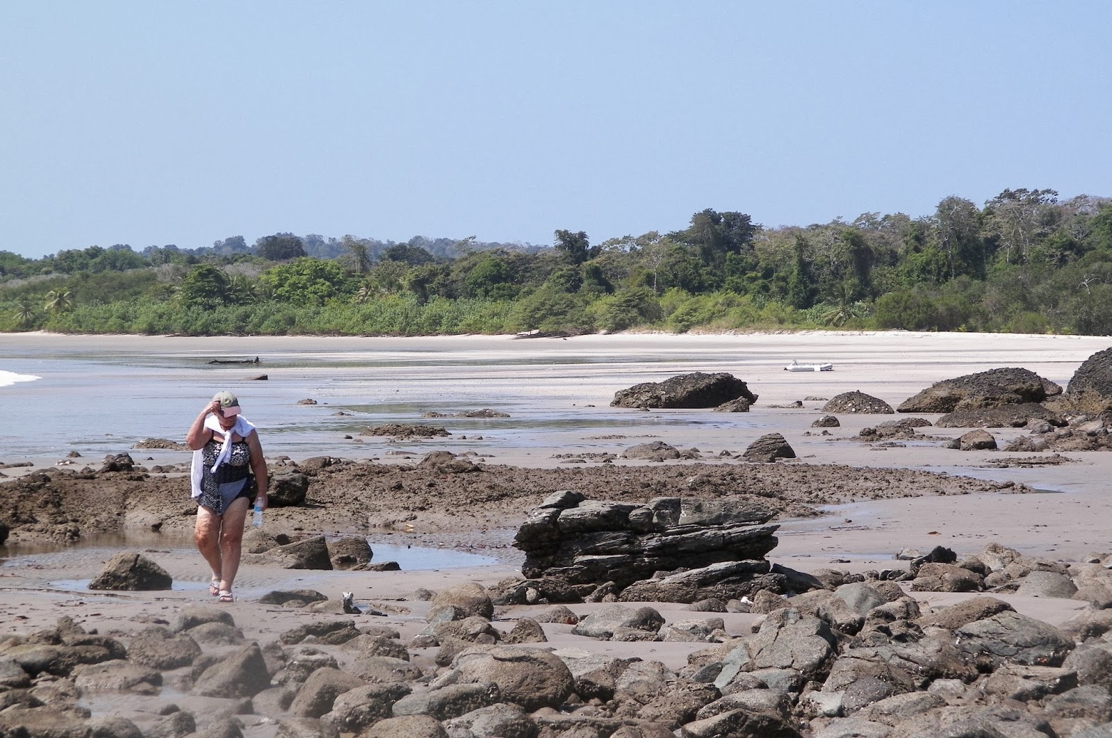
The expedition continued as we explored the beach and stream, which turned to be a tidal wash. This area of Panama has twenty foot tides. We scared a couple of iguanas and left our foot prints in a remote beach. We witnessed a bait ball feeding frenzy as any bird with in range flew in to take advantage of the food. A very successful day.

The next day we went to an anchorage between Isla Chapera and Isla Mogo Mogo where they filmed Survivor Las Perlas. We are sure that we found one of the camps as we saw stacks of bamboo, which doesn't grow on the island, and the remains of a camp fire along with other signs. We took on piece of bamboo to the boat and cut it up for souvenirs.

Our final couple of days will be spent at Isla Contadora, a small community in the northern islands. We have some rally things to do along with taking on fuel before the trip to the Galapagos.


Saturday, February 1, 2014

Ruder repair

We are now out of the yard with a working rudder.  The real problem was a broken rudder tube not a dropped tube. Beneteau, I belive made a defective product.  The tube was exposed and bare for the last 5 inches. The tube broke at the bearing and then wore down the remaining tube until the rudder had limited movement between two bolts that hold the rudder stop down. 

The yard we were in was great.  They improvised a tool to clean the old tube out of the boat so we could install the new one.  The only problem was the new tube was thicker than the old one. (Maybe Beneteaue corrected the problem in later boats). The yard again improvised by turning the tube on a lathe.

We did take Murray Yatch's advise and epoxied the exposed part of the tube to the wood around the rudder post and built a cone of epoxy to the rudder bearing. The engineering on the rudder shaft was excellent as with the new tube and two new shims,  there is not any up or down movement in the rudder.

The fix looks good so tomorrow we are off to Las Perlas Islands.